The year 2020 has started with high levels of precipitation especially in the south of Sweden. Together with relatively few days of sub-zero temperatures this has led to high discharge in streams and rivers. Several of the rivers in southern Sweden have been reported to flood their surroundings to various extent. Geographically Asa Field Research Station is localised in the headwaters of Mörrumsån which is one of the rivers that is causing flooding. SVT news (Sveriges Television Aktiebolag) reported about the situation in Blekinge (in Swedish).
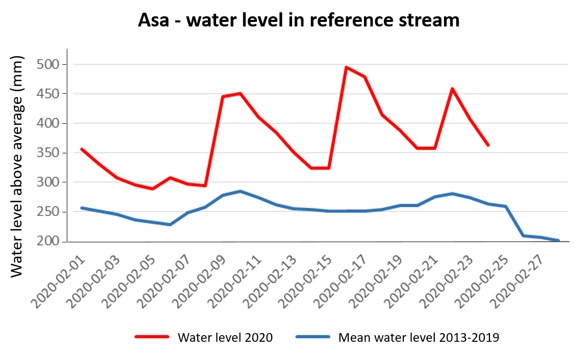
The water level in the reference stream at Asa Field Research Station has been above the average level of 252mm (reference water level) for the whole month. The average level for February 2020 will be about 370mm above reference height, which is the highest since the start of the monitoring programme in 2013.
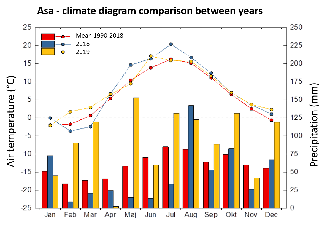
However, not only the first months of the year have been wet. At the meteorological station in Asa the highest level of precipitation was recorded during 2019 since the station was established 30 years ago: In total 1106 mm, which exceeds the former peak value with over 200 mm (900 mm in 2004).

Air temperature (°C) and precipitation (mm) recorded at Asa Field Research Station for the years 2018 and 2019 in comparison with the average over the years 1990-2018.

Water level monitoring at Asa´s reference stream; high water levels in 2020 compared to the long-term mean (years 2013-2019).